Investor-grade site and market reports, every figure sourced and dated, released by an analyst.
24-hour turnaround where our parcel layers are complete. Screen, don't decide — ranked evidence, sourced figures, named gaps. Nothing is auto-sent; a person reads every report before you do.
For site-acquisition teams who work one search ring at a time.
Edge / proximity compute & data centers
For operators and developers siting 1–20 MW of edge or proximity compute: which counties are worth a search, then which parcels are worth a visit.
PCS Market Scan
Not a parcel screen. Not a site visit.
- Demand by industry, power cost and who serves each county, business fiber and exchange points in reach, interconnection queues and dated announcements.
A ranked county report for a 1–20 MW edge or proximity-compute brief. Demand by industry, power cost and who serves each county, business fiber and exchange points in reach, interconnection queues and dated announcements re-fetched from the publisher.
Every figure is sourced and dated. A person releases it. Nothing is auto-sent.
A paid Scan credits 100% of the fee you actually paid toward a Scout Shortlist for 90 days.
REQUEST SCOPE →PCS Scout Shortlist
Not a site visit. Not a title search. Not a permit.
- Parcel cards: acreage against the county map, flood, slope, distance to transmission, nearest named substation, assessed value where published.
Parcel cards inside an area you already care about: acreage against the county map, flood, slope, distance to transmission, nearest named substation where the source names it, assessed value where published, and a call list for everything no public dataset answers.
A Market Scan paid in the last 90 days credits 100% of the fee actually paid — not the list price.
REQUEST SCOPE →Every number is reconstructible.
Dataset, exact vintage, pull date, how-to-verify — per figure. Find one you can't reconstruct and the scan is free.
Every claim is dated and linked.
Momentum evidence comes from dated sources with links verified to render — our own checker re-fetches every page and finds the quoted sentence on it. Failures are discarded and counted.
We score only what we measured.
Thin public momentum is labeled exactly that — badged, capped, never dressed up. An absent source is a named gap, not a guess.
The math is published.
A geometric mean of independently-sourced legs times a visible friction dial. The Gap Ratio formula is versioned and printed in your appendix.
The ranking admits its wobble.
Every report states how far the weights must move to change the #1. Near-ties are called near-ties, not verdicts.
Our failures are ours.
If a source goes down, your report says which one and when — and the credit comes back. It never renders as a fact about your market.
Cell towers & wireless
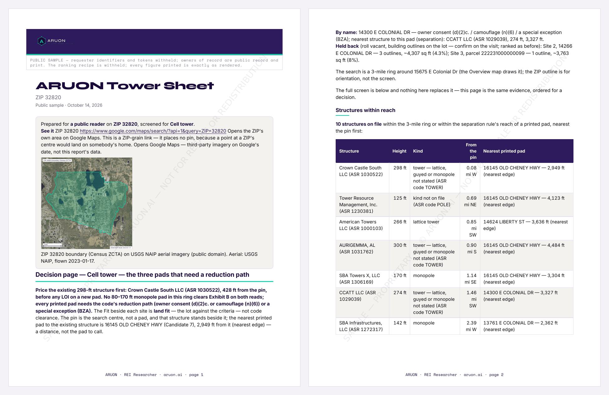
For tower owners, carriers and site-acquisition teams: one tower parcel's whole record, ground that fits your ring, or the towers the register does not hold.
ARUON Tower Sheet
No RF study. No claim of available utility capacity. Not a permit.
- Ranked candidate tower sites with owner of record and assessed value; every FCC-registered structure and FAA-charted tower in reach, measured under the jurisdiction's separation rule; the siting rule quoted with its section; a labelled ground-rent benchmark.
Ranked candidate tower sites in a ring around your pin, each with its owner of record, assessed value, lot size and mapped district, screened for flood, wetlands, slope and habitat. Every FCC-registered structure in reach, with its owner, and every tower on the FAA's charted-obstacle file, which adds shorter ones the FCC file does not hold, is measured against each site under the jurisdiction's own separation rule where it writes one, and that siting rule is quoted with its section in an appendix. A labelled national ground-rent benchmark, and the open questions to settle with the permitting authority.
Where we hold a certified registry-of-deeds read of the ground under a ring's tower, the sheet adds that chain of title, with book, page and document numbers.
No RF study. No claim of available utility capacity. Zoning is screened from the live layer in New York City, 16 Virginia localities, the City of Dallas, the City of Fort Worth, the City of Garland, the City of Arlington, the City of San Antonio and 7 more Texas cities, 11 Florida jurisdictions, 11 North Carolina jurisdictions, unincorporated Anne Arundel County, unincorporated Dorchester County, the City of Fayetteville, the City of Bentonville, the City of Pea Ridge, 9 Minnesota jurisdictions, 11 Tennessee jurisdictions, 7 South Carolina jurisdictions and 11 West Virginia jurisdictions; everywhere else we confirm it with the authority — we do not invent a district.
Red flags on a parcel
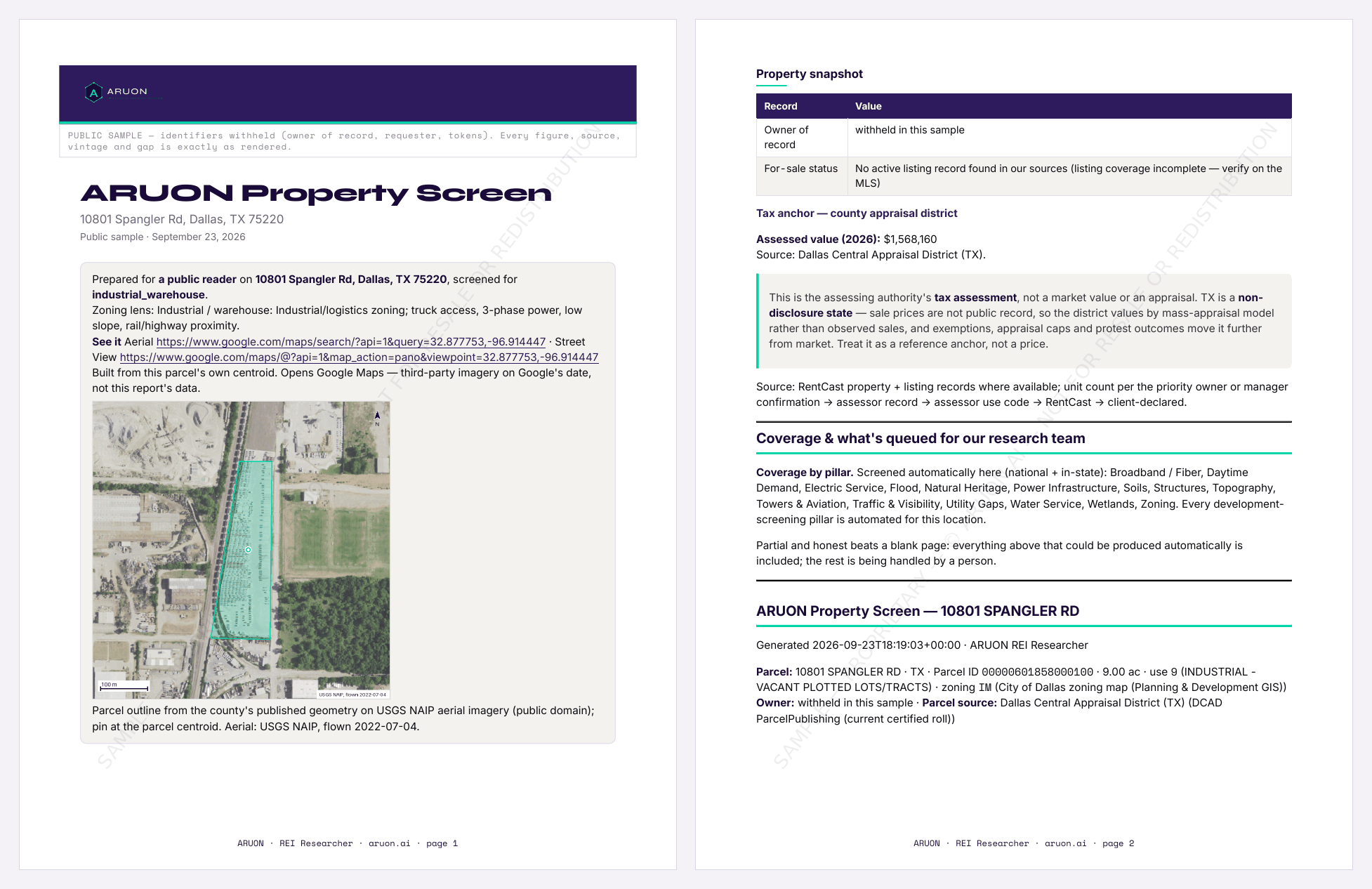
For anyone about to spend the next dollar on one address: the screen before the deposit, for storage, retail, industrial, housing or a tower site.
ARUON Property Screen
Not a Phase I. Not a PZR. Not a permit.
- Owner of record, flood, wetlands, slope, soils, habitat, electric territory, transmission proximity, broadband.
- Traffic and daytime demand when the use needs them; NOI, cap rate, cash-on-cash and DSCR when you give an asking price.
Address or parcel ID in, analyst-released PDF out: owner of record where we hold the county, flood, wetlands, slope, soils, habitat, electric territory, transmission proximity, broadband. Traffic and daytime demand when the use needs them. NOI, cap rate, cash-on-cash and DSCR when you give an asking price.
Same product for storage, retail, industrial, housing, data center, or a tower site. Tower sheets add the FCC-registered and FAA-charted structures in the ring. No RF study. No claim of available utility capacity.
Zoning is screened from the live layer in New York City, 16 Virginia localities, the City of Dallas, the City of Fort Worth, the City of Garland, the City of Arlington, the City of San Antonio and 7 more Texas cities, 11 Florida jurisdictions, 11 North Carolina jurisdictions, unincorporated Anne Arundel County, unincorporated Dorchester County, the City of Fayetteville, the City of Bentonville, the City of Pea Ridge, 9 Minnesota jurisdictions, 11 Tennessee jurisdictions, 7 South Carolina jurisdictions and 11 West Virginia jurisdictions; everywhere else we confirm it with the authority — we do not invent a district.
Housing screen on a ZIP
For investors deciding whether a ZIP is worth the trip: rent, value, inventory and demographics for its housing stock, benchmarked against the metro, the state and the nation.
ARUON Housing Screen
Not a commercial market study. Not a parcel screen. Not an appraisal.
- Rent, value, price index, inventory and demographics, benchmarked ZIP to metro to state to national, plus three investor profiles.
Rent, value, price index, inventory and demographics for the housing stock in one ZIP, benchmarked ZIP → metro → state → national, plus how three investor profiles — balanced, cash-flow and appreciation — read it differently.
Order for any U.S. ZIP. Where a ZIP's public data is too thin to benchmark, we tell you before you pay rather than charge for a thin report. Not a commercial market study. Not a parcel screen. Not an appraisal. It does not carry the 24-hour parcel clock.
I have criteria — find the ground
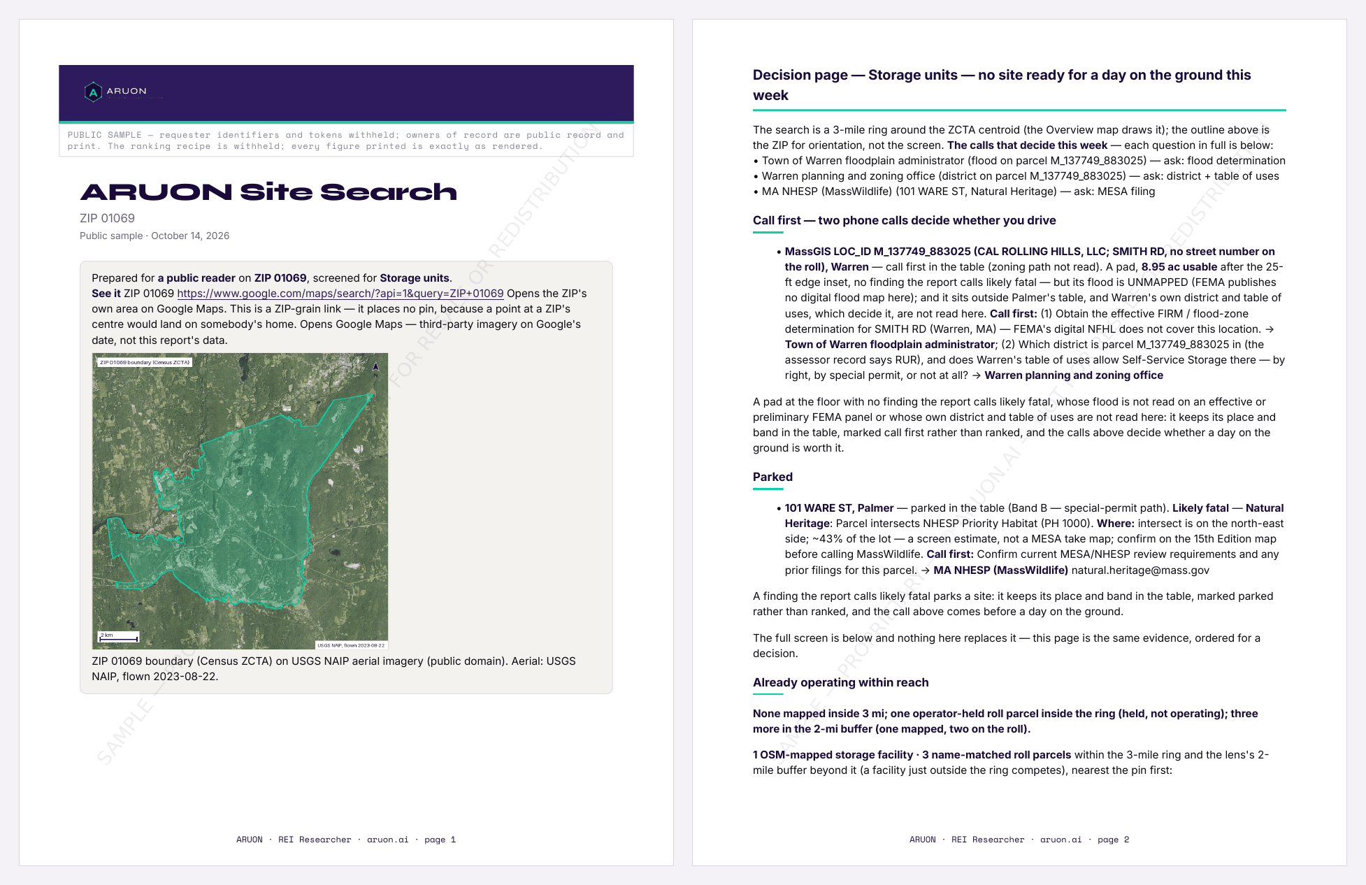
For anyone with criteria and no address yet: the search radius, the acreage floor and the constraints that matter in, ranked candidate parcels out, for commercial, industrial, storage and retail ground.
ARUON Site Search
For buyers who have criteria and no address yet.
Not a site visit. Not a title search. Not a permit. No RF study.
- Ranked candidate parcels screened against floodplain, wetlands, slope, transmission proximity and broadband; ownership and acreage from the county's own roll where we hold it.
Ranked candidate parcels inside a ZIP or county you name, for commercial, industrial, storage and retail ground. You set the search radius, the acreage floor and the constraints that matter; we screen every candidate against the public layers and hand back a ranked list with the instrument that measured each one.
Screened against: FEMA NFHL floodplain, USFWS National Wetlands Inventory, USGS 3DEP slope, HIFLD transmission proximity, FCC Broadband Data Collection. Ownership and acreage from the county's own roll where we hold it.
Not a site visit. Not a title search. Not a permit. No RF study.
Every figure carries its source.
Dataset, exact vintage, pull date, how-to-verify — per figure, in the report you receive.
An absent value is a named gap.
We print what we could not get and who we asked for it. An absent source is a named gap, not a guess.
A person signs every release.
Nothing auto-sends. An analyst reviews each report, approves it personally, and the release is recorded in a ledger.
What does a Tower Sheet include?
How is a report released?
Where does the data come from?
What if my county is not covered?
How fast is the turnaround?
Contact the Research desk
Tell us what you are looking for — a market, a site, a screen, a question about coverage — and an ARUON analyst will reply by email.
Every report is researched, reviewed, and signed off by the ARUON team · Texas, USA. Nothing auto-sends: a person reviews and approves every release.
Privacy · Terms · SMS terms